Free
€0
Forever
- Unlimited workouts, with screens for each sport
- 1 offline map region (up to 50 MB)
- 2 routes on the watch, 3 planned routes
- Full history of your Health workouts
- GPX export

Apple Watch and iPhone · early 2027
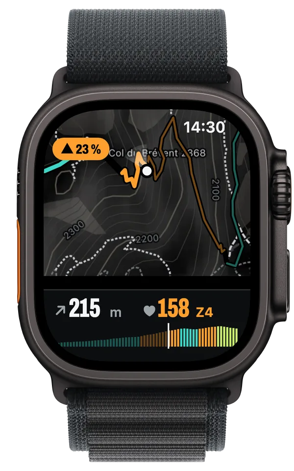
Trails, contour lines and terrain, downloaded on your iPhone and stored on the watch. Your route sits on top, coloured by gradient.
Offline map
The background is dark and grey on purpose. Trails are white, with tighter dashes once they turn alpine, and the shading comes from Copernicus terrain data. The only colour on screen is your route. It changes with the gradient, so you know before the bend whether the next bit is 8 or 25 %. Scroll down to climb Le Brévent.

No signal needed
That's the size of the map for the French part of the Tour du Mont Blanc, 2 km either side of the route. Before you leave, your iPhone downloads the area you framed, or the corridor around your route, and sends it to the watch. From then on the watch manages on its own: map, navigation and recording all work without your iPhone and without signal. On the iPhone, the same map sits under every workout.
Maps © OpenStreetMap contributors. Terrain: Copernicus DEM GLO-30, provided under Copernicus by the European Union and ESA.
01Routes
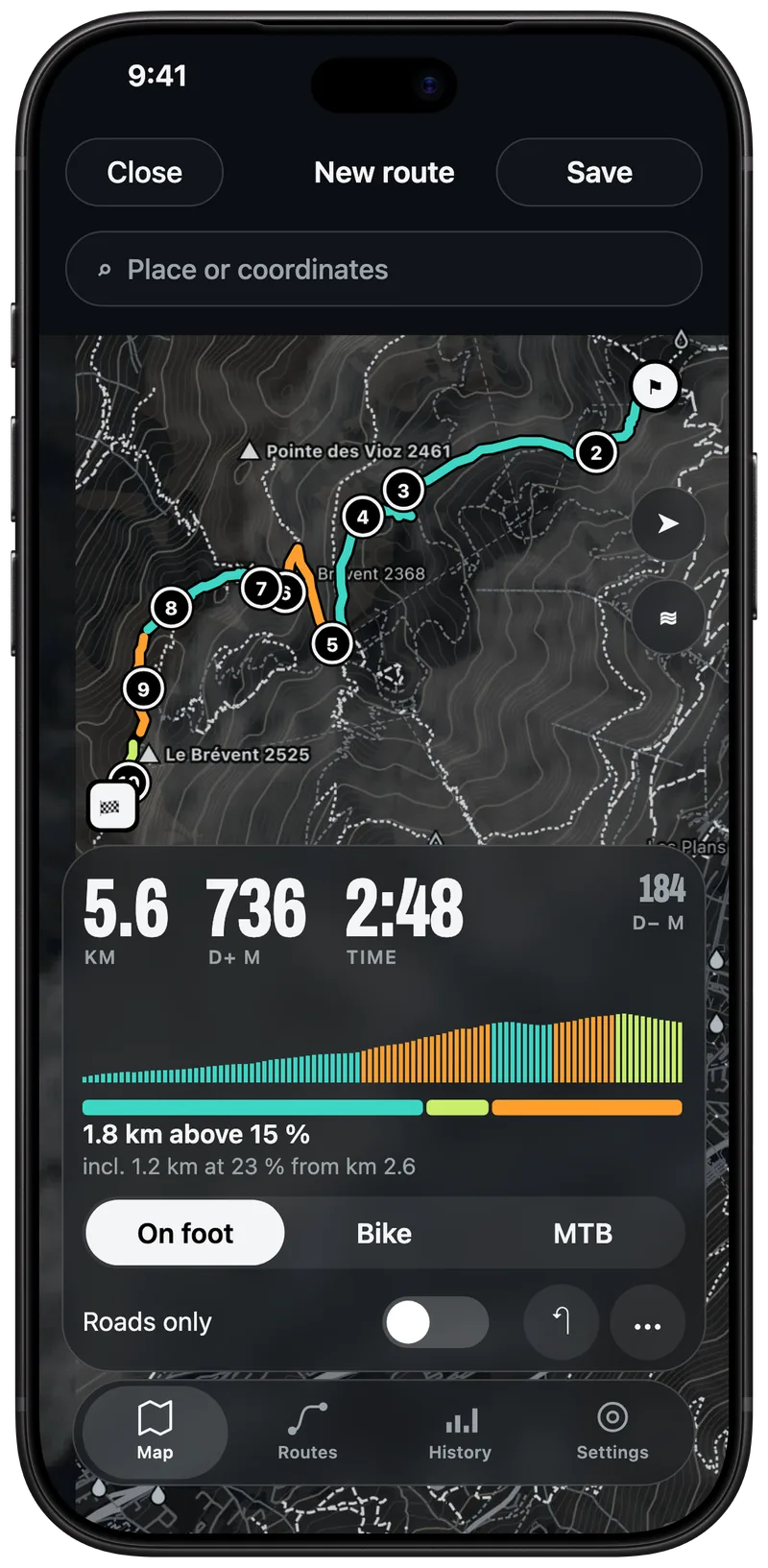
Tap the map and Ometto joins your points along the paths. Before you've laced your shoes, you know the distance, the climb, the expected time for your sport and how many kilometres fall in each gradient class. On this loop above Chamonix, that's 1.8 km above 15 %, which gives you time to prepare mentally.
1.8 km above 15 %, including 1.2 km at 23 % from km 2.6.

02On the watch
The map fills the screen and your numbers fit in a band at the bottom. When a climb is coming, the watch tells you its length and average gradient before you're on it. All of it runs without your iPhone and without signal.
Your route coloured by gradient, your position, and the profile moving along with you at the bottom.
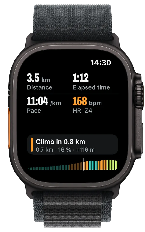
Each sport comes with its own screens, which you can change from your iPhone. The next climb shows up with its distance, gradient and height gain.
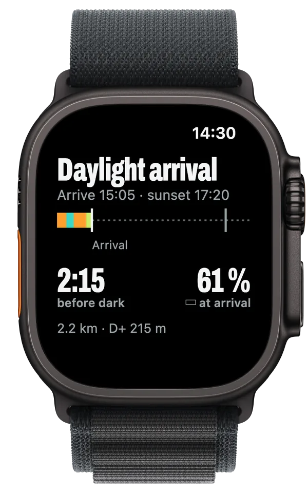
The time you have left, worked out from the gradient ahead, against sunset and your battery.
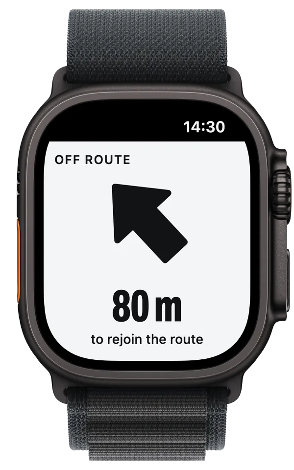
The screen turns white, an arrow points to the route and the watch taps your wrist. Hard to miss, even on a descent.

Will I make it?
Ometto works out your arrival time from the gradient still ahead of you, not from a flat average, and compares it with sunset. It also estimates how much battery you'll have left. Handy around 4 pm in November, when the car park is still a long way down.
Daylight arrival
Arrive 15:05 · sunset 17:20
03Analysis
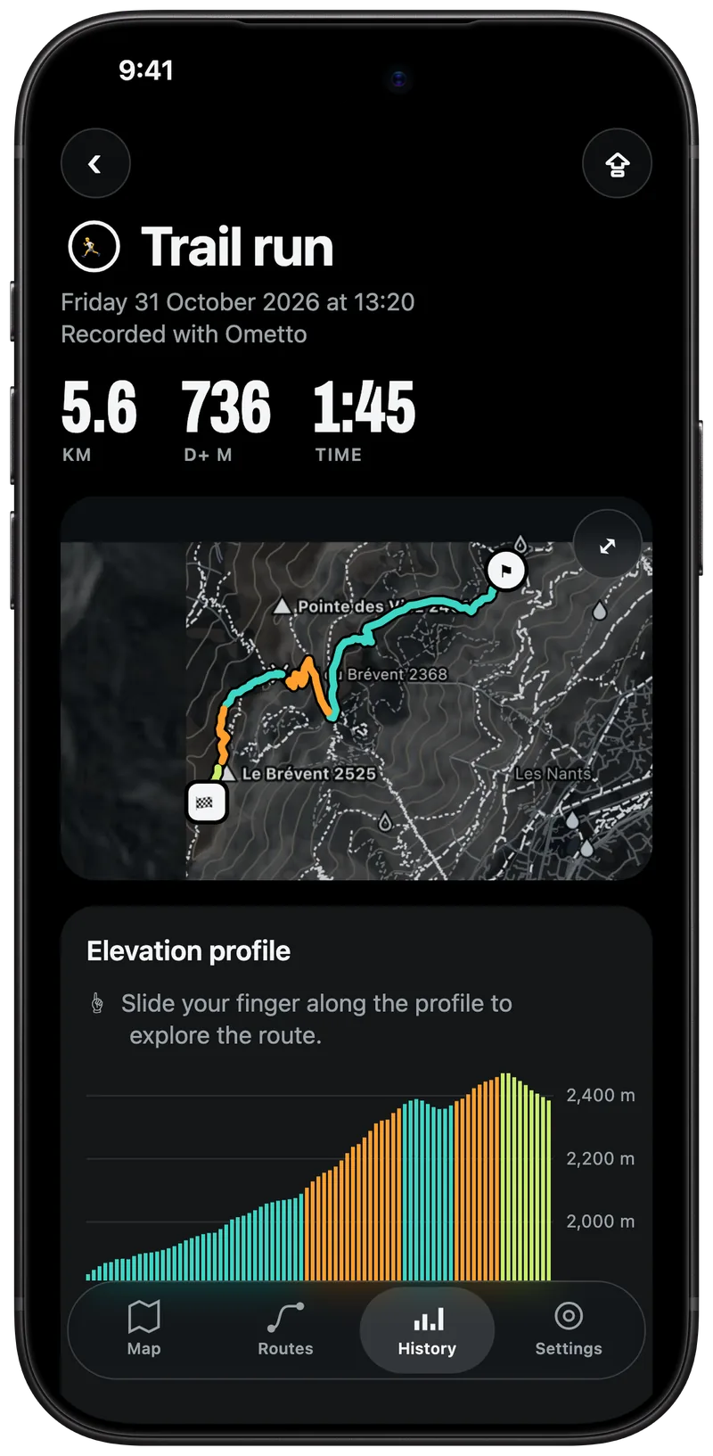
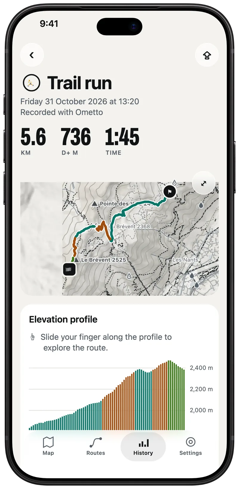
Ometto reads the outdoor workouts in the Health app, including the ones recorded with another app. For each one you get the map, the profile coloured by gradient, your heart-rate zones and your records.
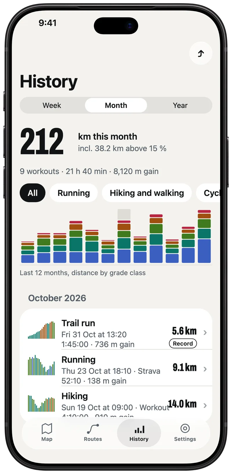
Your history is free. Zones, records and the rest are in Pro.

Each sport has its own data screens, set up for your first outing. If you want something else, you change them from your iPhone.



Made in Europe
The app speaks English, French, German, Italian and Spanish. There's no account to create, and your workouts stay on your devices and in Health.
Planned launch prices, in euros, VAT included.
€0
Forever
€29.99per year
7-day free trial · or €4.99 a month
Prices may still change before launch. Purchases go through the App Store and are handled by Apple.

One email when the beta opens, another at launch. That's it.
Launch is planned for early 2027 on the App Store. Waitlist members hear first, and some of them will be able to test the beta before that.
Ometto needs watchOS 11 and iOS 18 or later. The exact list of models will be published before launch.
No. Once the map and route are on the watch, it manages on its own. Map, navigation and recording work without your iPhone and without signal.
France, Switzerland and Italy today, the rest of Europe next. Maps come from OpenStreetMap and terrain from the Copernicus model.
Yes, as GPX and TCX. You can also draw your route in the planner. Your workouts export as GPX (free), TCX and FIT (Pro).
Yes. Ometto reads outdoor workouts from the Health app, whichever app recorded them. There's no direct Strava connection at launch.
No, Ometto only runs on Apple Watch and iPhone.
No account: your workouts stay on your devices and in Health. For the waitlist, we only keep your email and your choices, until launch or until you unsubscribe. It's all in the privacy policy.